Featured Member: Cross NH Adventure Trail
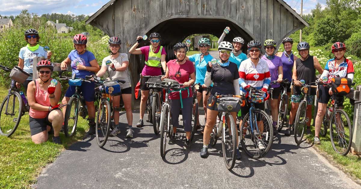
The Cross New Hampshire Adventure Trail (xNHAT), one of the Chamber’s newest members, is an 83-mile scenic route that offers outdoor enthusiasts a blend of rail trails, dirt roads, and quiet backroads, ideal for bikers, walkers, runners, and more. Founded in 2017 by Marianne Borowski, xNHAT promotes off-road travel and cyclo-tourism through the North Country of New Hampshire, providing safer alternatives to busy highways. Borowski’s focus has been to link these quieter trails and roads, making travel more accessible and safer for cyclists of all experience levels.
Borowski is passionate about creating an environment where cyclists can enjoy the outdoors without the risk of high-speed traffic. “The spirit of the route is to be off-road or on quiet back roads as much as possible,” says Borowski. Her work aims to encourage more people to use bikes for transportation while also boosting local economies through increased tourism. She acknowledges that many cyclists, especially those who may have enjoyed riding on roads in the past, are increasingly seeking safer alternatives due to the rise in traffic volume and distracted driving.
Regional Collaboration for Success
In collaboration with groups such as the Rails to Trails Conservancy and local trail organizations like Parker Mountain Trails, Bethlehem Trails Association, and Franconia’s Profile Trail Network, Borowski and xNHAT have made significant progress in expanding bicycle access across the region. This expansion improves recreational access and enhances local economies through increased tourism and outdoor activities.
The key to this development has been the focus on enhancing the Presidential Rail Trail and Ammonoosuc Rail Trail, two critical segments of the xNHAT network. The Presidential Rail Trail is undergoing restoration to improve drainage and prevent weather-related damage. This work is vital to preserving the trail and ensuring it remains a valuable resource for outdoor enthusiasts for years to come. The restoration efforts supported by a 2024 Recreational Trails Program Grant include ditching, grading, and replacing culverts to manage water runoff and prevent erosion.
Similarly, the Ammonoosuc Rail Trail benefits from a partnership between xNHAT, the NH Bureau of Trails, and the Ammonoosuc Valley ATV Club. A hardpack surface is being applied to sections of the trail to make it more durable and user-friendly for cyclists and other trail users. The first test of this hardpack material, applied in Lisbon behind the local furniture factory, has proven successful in withstanding weather conditions and ATV use. More sections of the trail will receive this treatment in late summer 2024, enhancing the experience for riders from Bath to Lisbon.
Expanding Partnerships
Borowski’s vision for the future of the Cross New Hampshire Adventure Trail involves continued partnerships with regional ATV and snowmobile clubs to ensure that multiple user groups can benefit from the trails. These collaborations, along with her work with state agencies such as the New Hampshire Department of Transportation (NHDOT) and the Bureau of Trails, are essential to the long-term success of xNHAT and its goal of expanding human-powered transportation options in the region.
For outdoor enthusiasts planning to explore the trail, xNHAT provides a variety of resources, including a detailed 7-panel waterproof accordion-fold map, available free of charge to trail travelers. These maps, which have been distributed to over 7,000 users, are invaluable tools for navigating the route’s scenic river valleys and forested landscapes. For those who prefer digital resources, xNHAT’s Story Map offers an interactive way to explore the trail and plan a trip.
The Cross New Hampshire Adventure Trail is more than just a recreational path; it’s a network that connects communities and fosters economic development across northern New Hampshire. By linking rail trails and backroads, xNHAT opens up new opportunities for both residents and visitors to engage with the region’s natural beauty while supporting local businesses.
For more information on trail conditions and upcoming improvements or to request a free map, visit xNHAT.


